#1: "TileProxy" project - Prettttty slick!!!!! Author: JG300-Stoopy, Location: Group W benchPosted: Tue May 01, 2007 10:16 am ---- "TileProxy" is a very interesting freeware development spearheaded and entirely due to the efforts of one very sharp dude who's figured out a way to attach a proxy service to a well-known provider of satellite images used in a very popular program which shall go unnamed but is similar to G**gleEarth.....the purpose of doing so is to use the G**gleEarth "tiles" as replacement for the scenery texture tiles (i.e., graphics) in FSX in real-time as you fly along.
Say WHAT???? Yes....exactly......instead of seeing generic scenery ground and building textures as you putter along, your system is actually connected with G**gleEarth and fetching/displaying the actual, real, hi-def satelltie images (where available) on the terrain instead. So, now, you really CAN fly over your house, if it shows up in the "other" globe/sat image utility. Sounds pretty far out, huh?
This is just now kicking off, there was an old thread with some very breathtaking screenshots and I can't find it now, but here's where you can keep in the loop on the goings-on and get some more info....quite exciting and I aim to try it out as soon as I get home!!!
Caveat is, from reading about it, it sounds like it does take a slightly higher amount of tech skill to set up, and you need BANDWIDTH baby, (hence why the author and users seem to prefer the sat image provider name doesn't get 'seen' by search 'bots on the web and blow the cover for now, although there isn't anything underhanded about this) but otherwise sounds like a good direction for flight sims to take in the future!
Ahh....here's a set of screenies the author made about 6 months back, flying over Hawaii and using the 'tool' to bring in the photoreal sat images as replacement textures....
#2: Re: "TileProxy" project - Prettttty slick!!!!! Author: Shadow_Bshwackr, Location: Central Illinois, USAPosted: Tue May 01, 2007 10:46 am ---- Yep, I seen that project too and like you, think this IS the future! Obviously, the more bandwidth you have the better and I bet the minimum required is stiff as well.
Still, this should be fun to experiment with and as with all technologies, it's a matter of time before the 'bugs' gets worked out and/or more people get bigger NET connections.
As little as 5 years ago, most (I would say 90% or better) of the people had dial up connections. I bet that ratio is considerably lower now days.
#3: Re: "TileProxy" project - Prettttty slick!!!!! Author: JG300-Stoopy, Location: Group W benchPosted: Sun May 06, 2007 3:25 pm ---- It is indeed, very very cool - with some caveats - it's not for the faint of heart or the non-technical, as it takes some HTTP proxy awareness to get working as well as some other configuration elements. It's capable of using data feeds from various sources whihc must be configured by the user so the author doesn't possibly get in trouble. Also, it extends flight loading (scenery load particularly) times very considerably - 5 minutes for the progress indicator to get to 100% is NOT an exaggeration. Lastly the tiles are memory-intensive and need to be swapped in and out to a fair degree, resulting on some temporary oddities that can be seen in some of the below pix. But getting past that, it's quite simply the most awesome "feature" I've ever seen when it's all done and loaded and flying.
Oh yeah - also, to give the new tiles ample time to load, you don't want to go real fast (i.e., no jets) or you'll get ahead of the scenery, just like in some of those popular globe-viewer apps. So, low and slow is the way to go, which is fine by me....
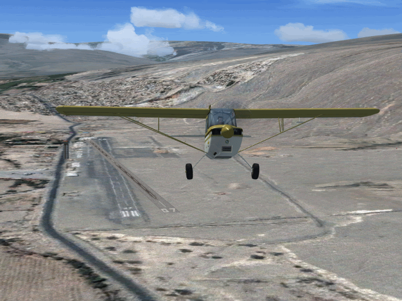
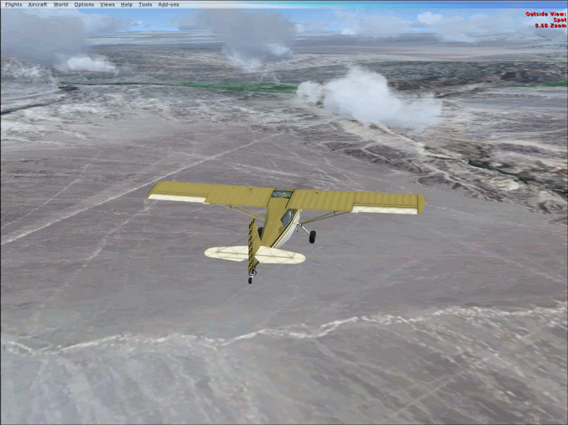
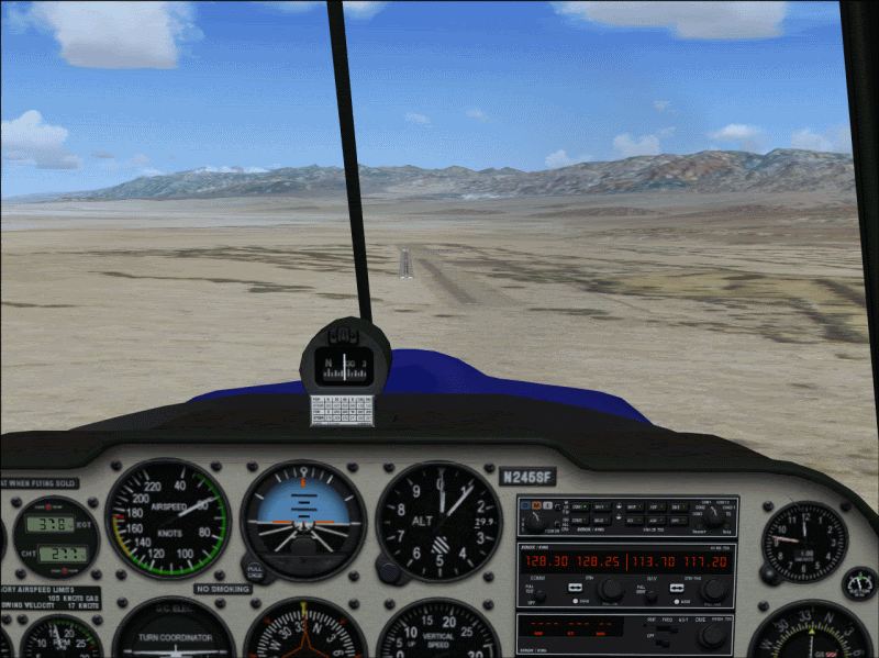
First stop was Nazca, Peru.....notice the artifact of the real airport runway in the terrain tile with the FSX airport scenery superimpsed over it. You see a lot of this, in this case the runway heading is off a bit......
Obviously, the satellite images on some tiles were taken on different days and light conditions, yielding a large patchwork effect as expected - no big really.....
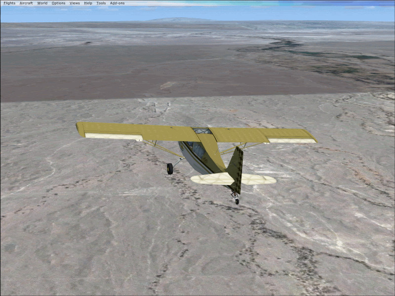
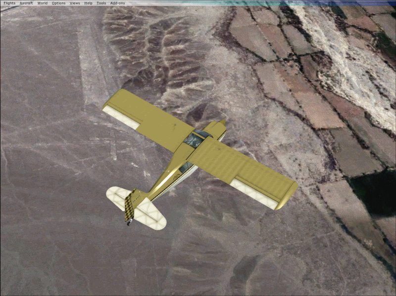
Looking back at the town of Nazca, a scenery tile has gone temporarily AWOL yielding the psychedelic effect you see - it'll load back up when we return to the airport....
But the scenery detail can be INCREDIBLE and here we're heading NW to the Nazca plains toward the infamous Nazca Lines.....
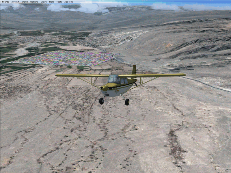
Note, way off the coastline, you'll see some large white tile patches - another artifact of the sat image feed, which you also see in the (cough) common "global image viewer" utilities out there.....white tiles indicating no sat image for that area, since there's little of interest.
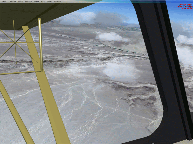
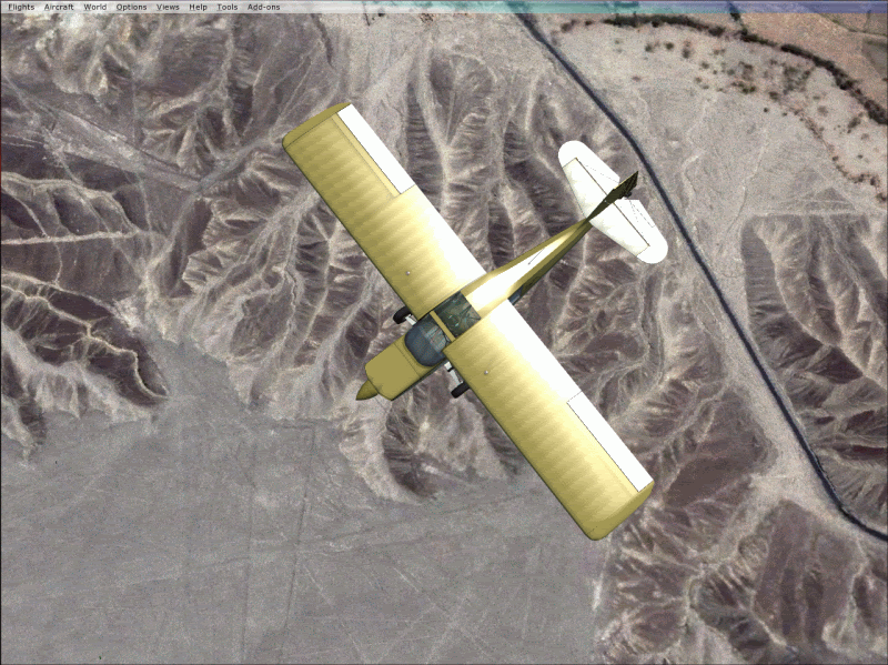
...and here they are right on queue, we're about 9,000 feet up (5 or 6,000 AGL) and it makes for some great scenery investigation!
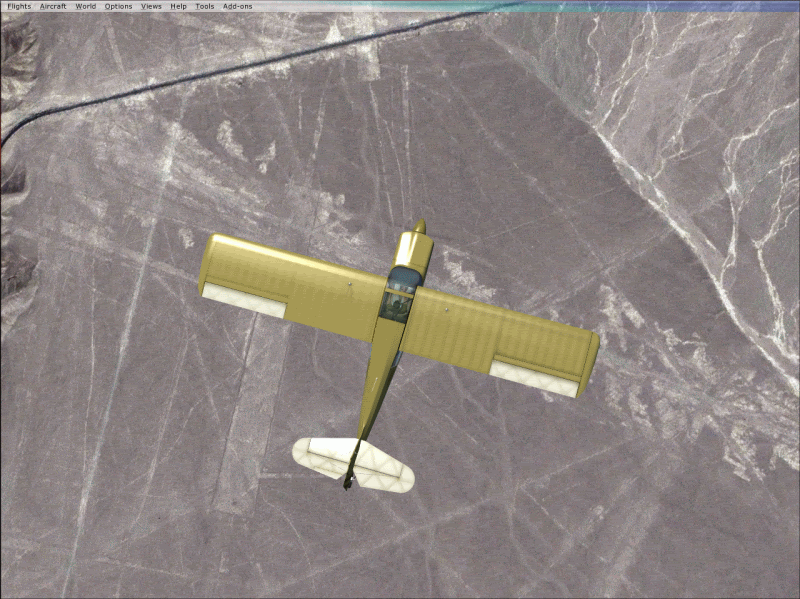
It may be hard to recognize the semi-famous "bird" image on the ground there (you gotta look hard and use your imagination) but it almost looks like the ancients were actually trying to pay homage to the mighty Super Decathlon, the wing and fuselage proportions look about right, guess they got invaded by the Conquistadors before they could get around to finishing the tail surfaces....thanks a pantload, Francisco Pizarro!!!!!
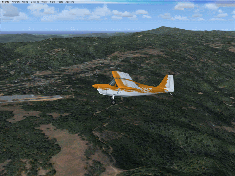
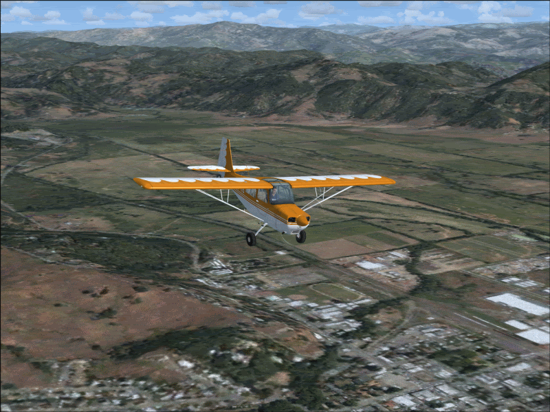
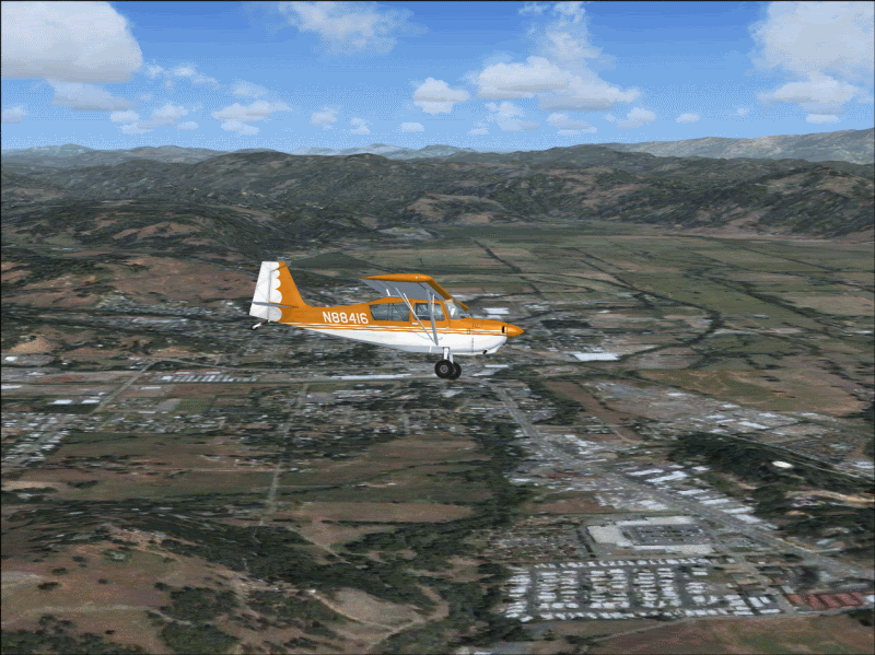
Paid a visit to an old hometown of Willits CA up north in Mendocino county - really wanted to do this because this is where I began taking flight lessons when we lived there. The airport (O18) is on top of a hill overlooking the town and makes for great flying.
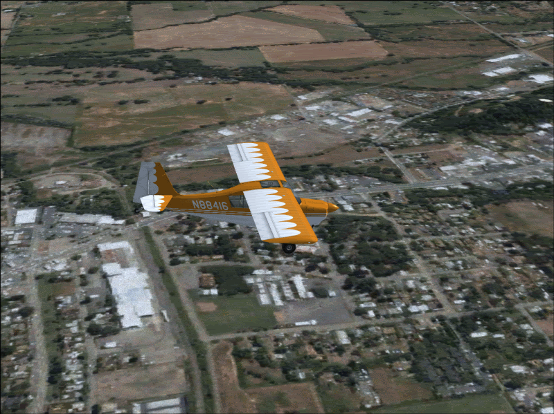
That football field down there is at the High School and I spent many an hour down there from playing "Pop Warner" football in the seventh grade up through the early high school years.....pretty damn slick to fly over the very field that has much blood sweat and tears in it.....GO WILLITS WOLVERINES, HOO YAHH!!!!!!!!!!
When I was taking flying lessons, we did our spin training over the fields in the background, I have a pretty good memory of looking DOWN at the cows through the windshield while the airspeed gauge was windng up.... instructor later admitted we went a lot deeper into the spin than he planned...
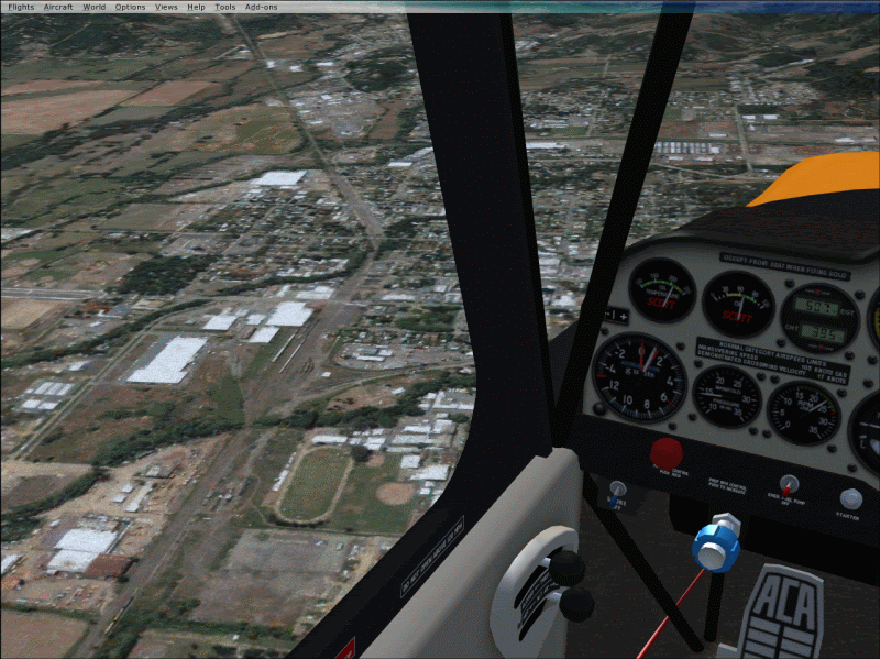
And here's the local middle school (green field beneath fuselage), and right under my main landing gear tire is/was our old house.....
There she be, Willits CA......
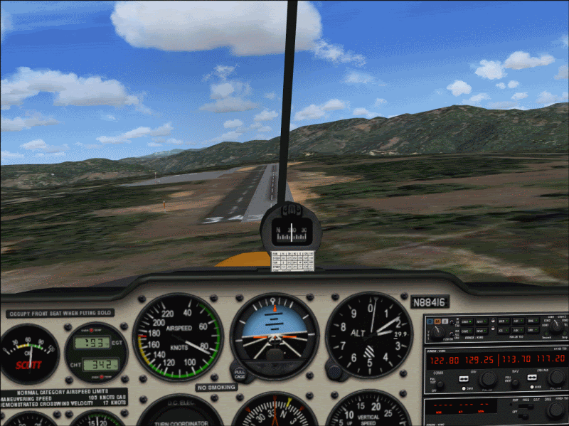
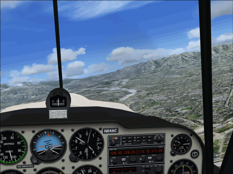
Another example of the real airport runway artifact underlying the FSX scenery - pretty accurate I'd say. I bet scenery designers would love this tool for getting their airport sceneries balls-on accurate!
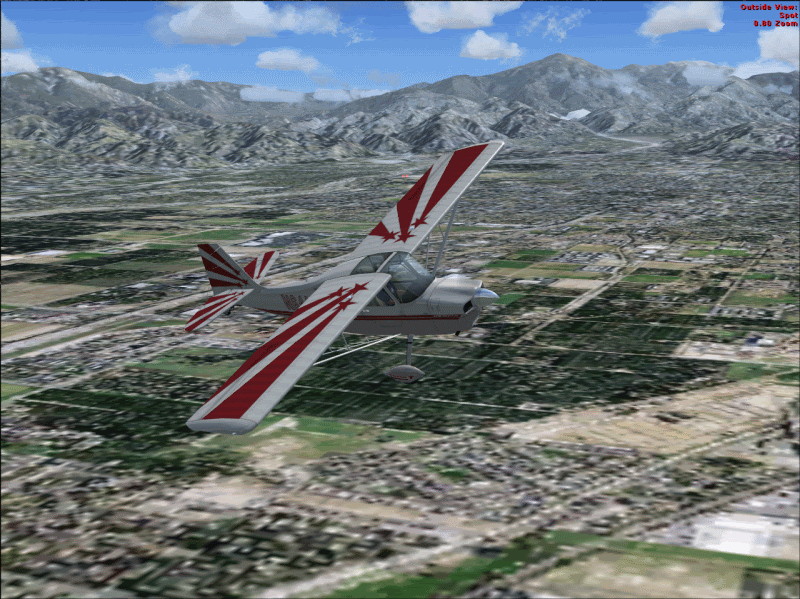
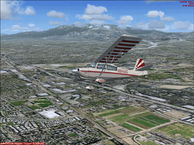
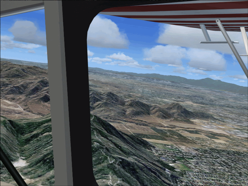
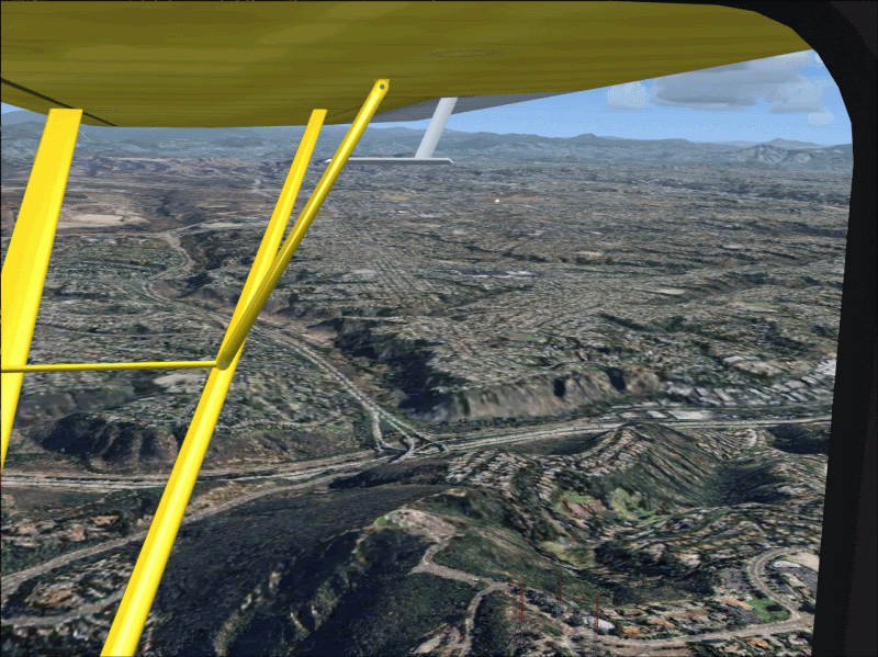
And lastly, puttered around another old hometown, the bustling metropolis of Mentone CA. The scenery here is interesting in that the atmospheric haze of So Cal has a definite influence on the color of the satellite images. But the mountains and foothills look AMAZING!
Looking NE toward Mentone/Yucaipa and Mount San Bernardino in the background....
NW toward San Bernardino/Rialto and Mt. Baldy back there.....
San Timeteo Canyon foothills......
Looking North toward Devore and the pass through the mountains that leads to the High Desert....Man, I tell ya I see some nice leasiurely x-countries in the immediate future!!!
Hopefully nothing drastic will happen with usage rights etc on the various sat image data feeds, and from what I hear, those who are interested but have neither the tech skills or interest in engaging in what is really "experimental" beta-level stuff right now may have something positive to look forward to in the months ahead! Either way, this is definitely the future and it's way way cool!
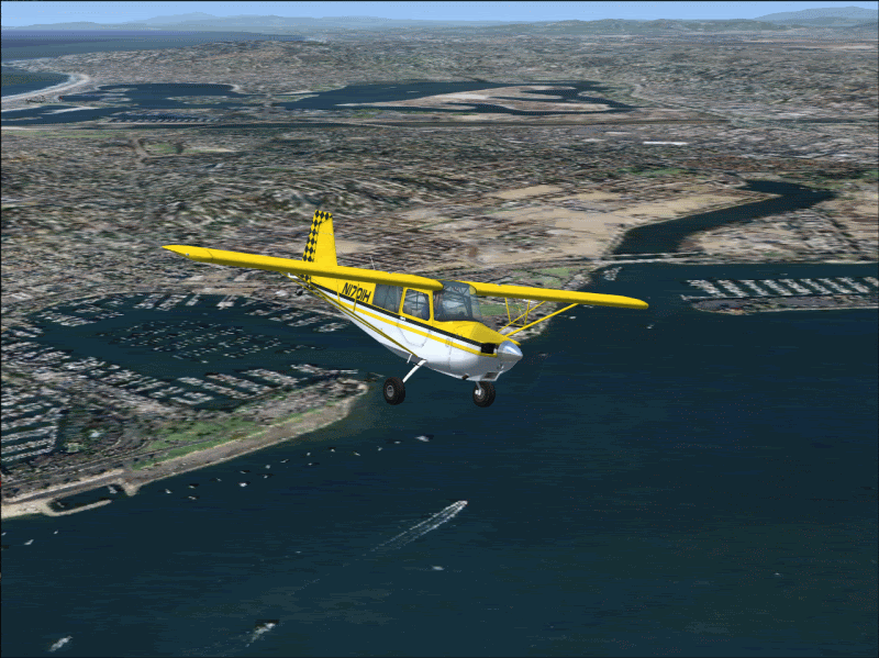
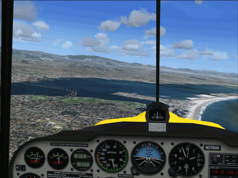
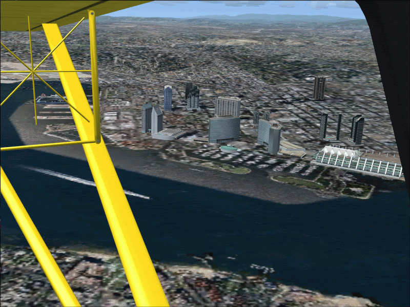
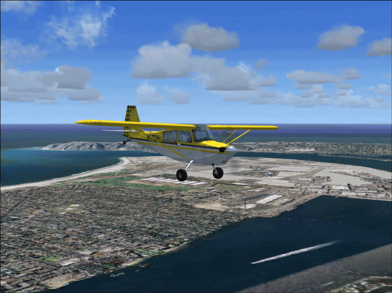
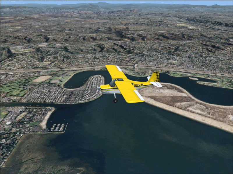
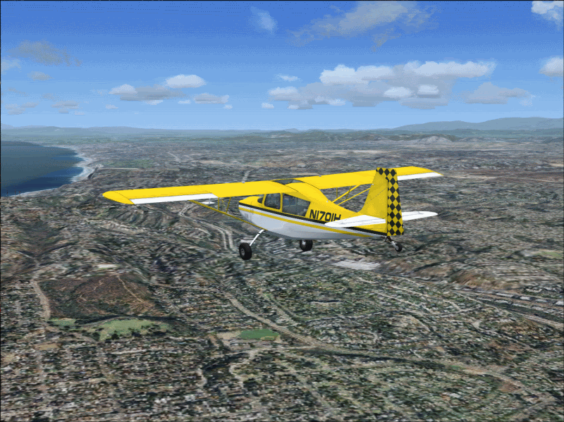
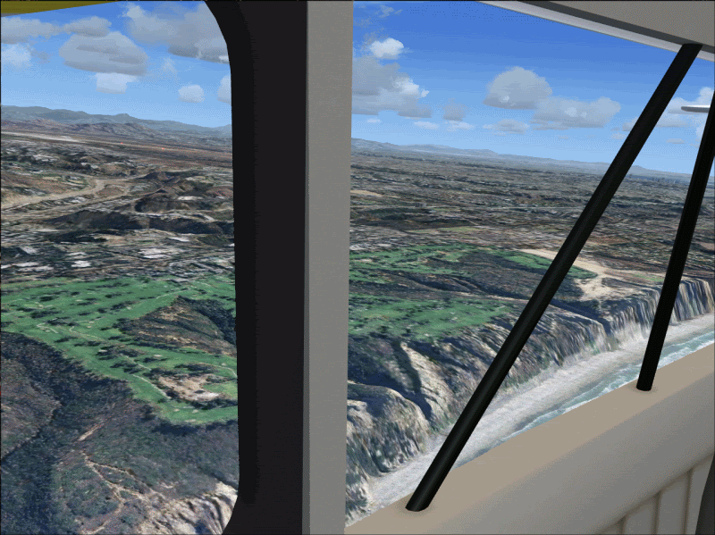
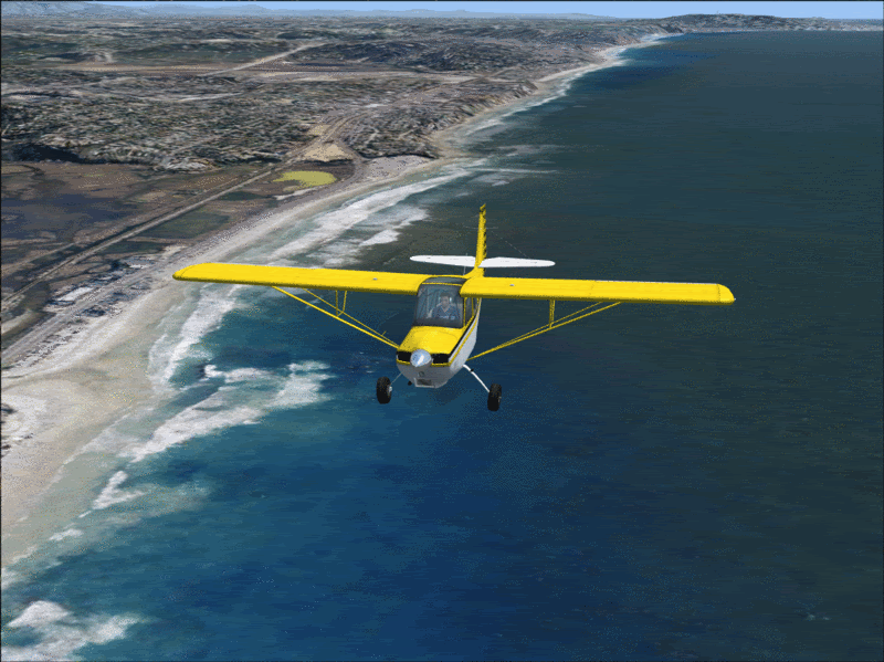
#4: Re: "TileProxy" project - Prettttty slick!!!!! Author: JG300-Stoopy, Location: Group W benchPosted: Sun May 06, 2007 6:34 pm ---- Can't help it - more shots, this time from San Diego and points immediately north......pretending I have my dream job, being one of those guys that tows banners up and down the beaches.....
#5: Re: "TileProxy" project - Prettttty slick!!!!! Author: JG300-fr8ycat, Location: Los AngelesPosted: Mon May 07, 2007 3:23 am ---- Wow, this looks awesome. Would love to give it a try in my area and refly my Solo Cross Country in the R22.
#6: Re: "TileProxy" project - Prettttty slick!!!!! Author: JG300_Hunt, Location: WA StatePosted: Mon May 07, 2007 5:12 am ---- AWESOME pics Stoop! Very very jealous! Would love if this tool was interactive with FS9, however with FSX the way of the future, I doubt an interface will be made. Very cool idea there! Can see some amazing screen shot entries being submitted!
#7: Re: "TileProxy" project - Prettttty slick!!!!! Author: JG300-Stoopy, Location: Group W benchPosted: Mon May 07, 2007 9:52 am ---- Glad ya's like it, and it's something to be aware of. It's not always peaches and cream though, as some places have pretty rough sat coverage and so the textures come out worse than default (the Pigsty looks horrible, sorry to say)...so don't get too jealous.
Someday, off in the future, some kind of automatic balancing between sat images and stock terrain tiles (maybe based on a threshhold of available sat image quality) might do the trick. Also, I haven't tried flying in low light conditions but I'm sure it will look impossibly weird with a nighttime black sky and fully-lit ground scenery.
Anyway.....I personally wouldn't submit any screenies to the screenshot contest or anything using this because the experimental nature makes it something of an unfair practice. But, Migod, when it works right it's something else....
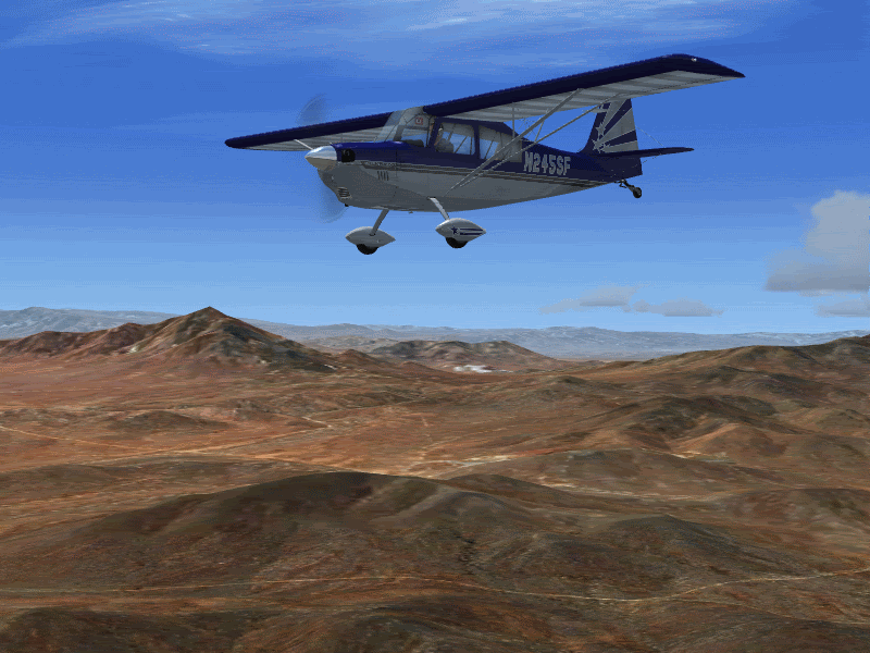
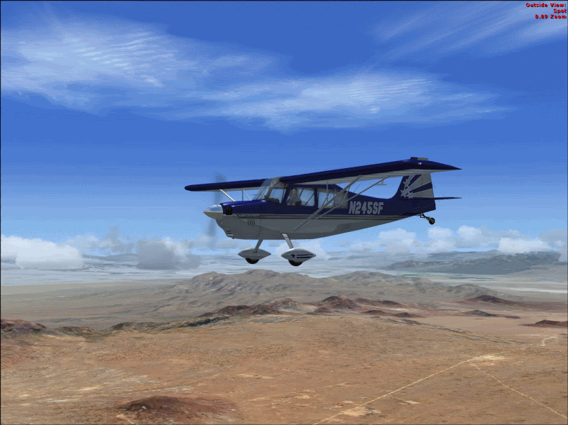
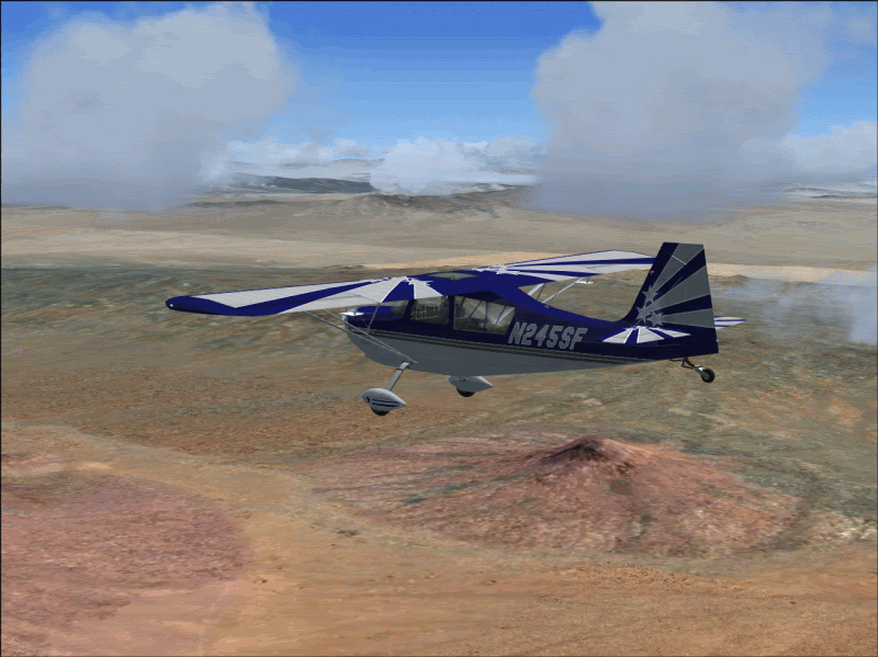
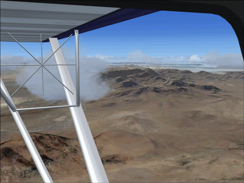
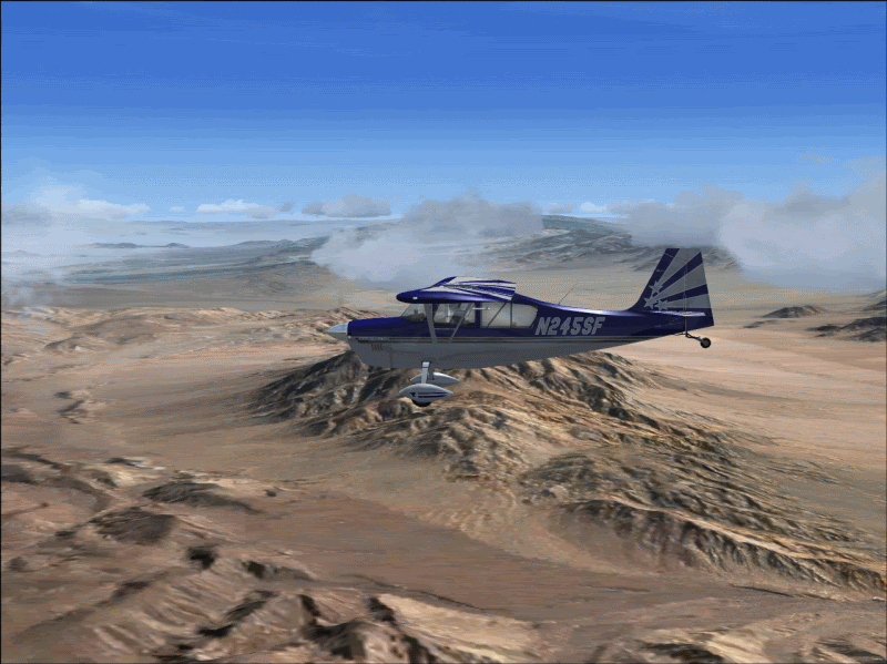
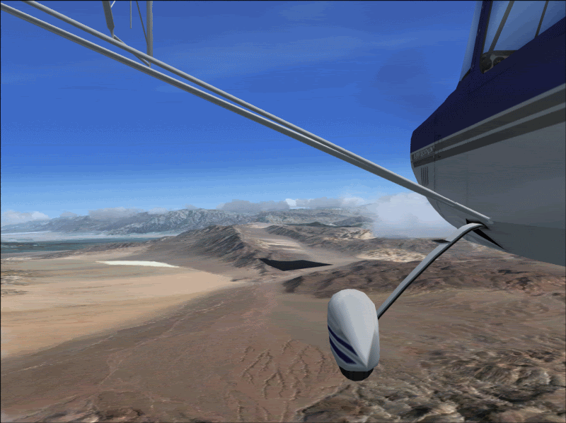
The desert is one of my absolute favorite places and I started a multi-leg x-country trip, took this shot on the way to Barstow, with Death Valley coming up next......who can say the desert isn't beautiful?
#8: Re: "TileProxy" project - Prettttty slick!!!!! Author: JG300-fr8ycat, Location: Los AngelesPosted: Mon May 07, 2007 4:13 pm ---- Since at this point it looks like it might be a little beyond my techy skills.....
if ya get the chance give this a go (my X-Country).
KVNY (Van Nuys) -> KWJF (Gen. Fox Field / Lancaster) -> L70 (Agua Dulce)
A nice mixture of City, Mountain and High Desert, maybe .5 to .75 flight time. Ya might even recognize Santa Clarita
#9: Re: "TileProxy" project - Prettttty slick!!!!! Author: JG300-Stoopy, Location: Group W benchPosted: Tue May 08, 2007 12:29 am ---- OOooooo...Santa Clarita (drools)...yup them hills are gonna look mighty fine!
Tell ya what. Just landed at Furnace Creek in Death Valley, lemme find a hose or something on the flightline that has some water (man it's HOT today!!) and then I'm gonna swing west and pop over the mountains to Watsonville, cruise by Steamer Lane in Santa Cruz then head up the coast a short distance and buzz Maverick's before I land at Half Moon Bay airport. Hear the surf is up....
You gotta deal!
#10: Re: "TileProxy" project - Prettttty slick!!!!! Author: Shadow_Bshwackr, Location: Central Illinois, USAPosted: Tue May 08, 2007 1:15 am ---- HOLY COW! That's REALLY incredible! Thanks Stoopy for the review and commentary!
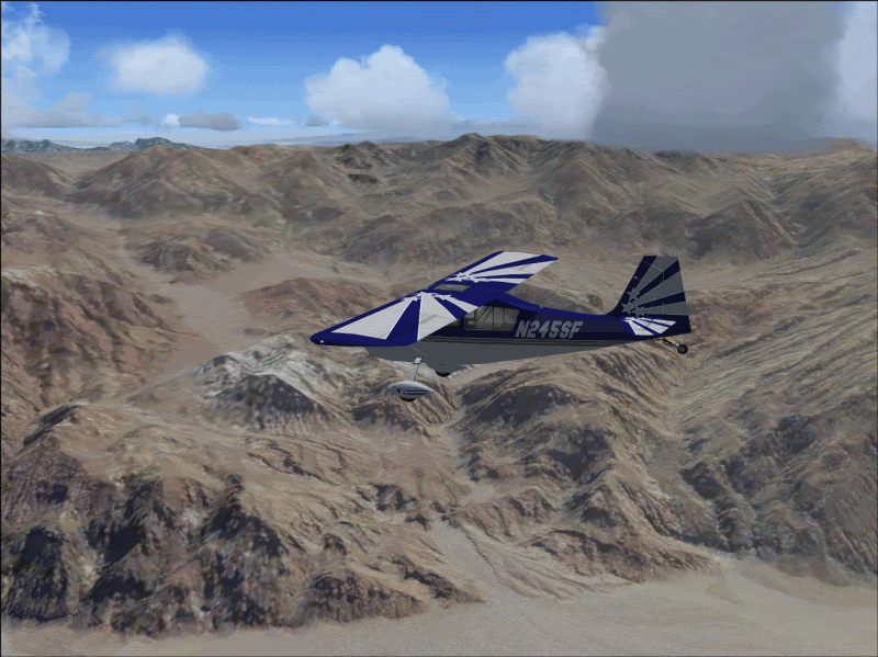
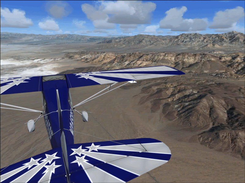
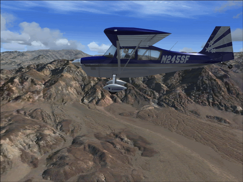
#11: Re: "TileProxy" project - Prettttty slick!!!!! Author: JG300-Stoopy, Location: Group W benchPosted: Tue May 08, 2007 10:28 am ---- Some shots from my little cross-country journey through the high desert from Barstow/Lenwood (Depue field) to Furnace Creek, Death Valley.....I'll hold off on the trip to Maverick's and do the Santa Clarita thing next.....
You know how some places are described as "the armpit of the world" etc.....well, apparently, Lenwood CA is very close to the nipple....
Entering the valley from the south.....
"The Hills Have Eyes"......
Kinda....salty....down there.....
Setting down at Furnace Creek, FS runway juxtaposed against the real one....
'Bout the only water around is what's in that coiled-up hose over there, and NO SHADE other than under the wings....but that's okay, we escaped and got away to some peace & quiet at last!
#12: Re: "TileProxy" project - Prettttty slick!!!!! Author: JG300-fr8ycat, Location: Los AngelesPosted: Tue May 08, 2007 12:17 pm ---- Man that's awesome.
#13: Re: "TileProxy" project - Prettttty slick!!!!! Author: JG300-Stoopy, Location: Group W benchPosted: Tue May 08, 2007 1:23 pm ---- Yep, and I hate to make anyone jealous but I also had my TrackIR going so I spent the whole flight just smoothly panning around with my head watching the scenery go by. You can kinda tell in some of the shots like the landing shot, I shifted my head to the right a little bit when looking at the runway so I didn't have the center windshield frame right in front of me. What an absolutely immersive flight experience, not to rub it in but it's one of the best I've ever had.....was sitting bolt upright in the chair to lift my head up a little bit extra to see over the nose on final, greased the ol' Super Deke on the runway and by the time I parked and shut down, I felt like I'd just completed the real thing. Only thing was, I kinda screwed the pooch on the weather selection, there shouldn't be puffy clouds at 5,000 feet over the desert in that season unless rain is coming. Shoulda used real Wx and got some high stratus clouds at 20,000 ft instead, or clear blue skies.
I'm trying to link one flight to the next so I take off from the last place I landed, and just wander to wherever I please and then go from there. Always loved doing that, and it actually helps with the TileProxy concept because the last scenery tiles remain cached on the hard drive and so the next flight loads quicker since it's not all new tiles that have to be fetched. Can definitely see taking several months to do a whole round-the-world flight in the Decathlon, might need to strap a 20 or 30-gallon fuel tank in the backseat to extend her range a bit but it would be one heck of an experience - do the whole globe at ~105 knots a stretch going wherever the wind blows...kind of a "Kung Fu" thing....
Although I feel the need to fire up and get out of there before dusk.....not sure where Charles Manson's old hideout is in relation to that airstrip, and I don't want anything bad to happen to my beloved Super Deke!
#14: Re: "TileProxy" project - Prettttty slick!!!!! Author: HF_SlowHand, Location: MeeechiganPosted: Wed May 09, 2007 10:05 am ---- now they are using google earth for live flight tracking too... watching my fiancees flight from Milan Italy to O Hare via Philly (Flight # USA717)... too kewl these day are! thanks stoopy!